
Description
Garmin Marine Electronics
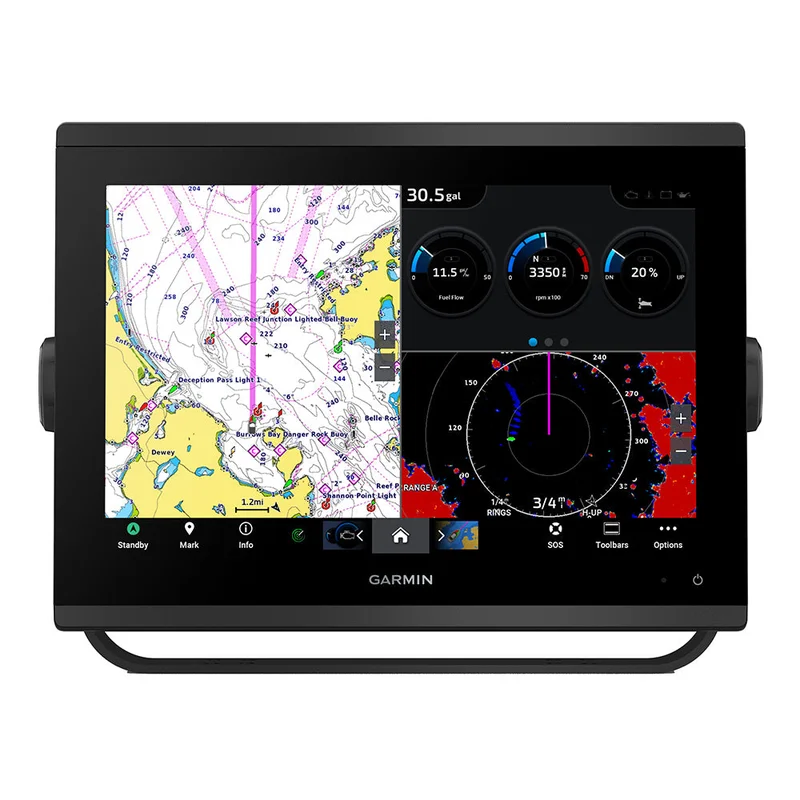
Garmin GPSMAP 1243 Chartplotter GN+ [010-02367-60]
MPN: 010-02367-60 • UPC: 753759285241 • SKU: FT-97019
You’re a boater who wants premium features, maps, and charts for your connected helm. This crisp 12″ high-resolution chartplotter makes that wish come true.
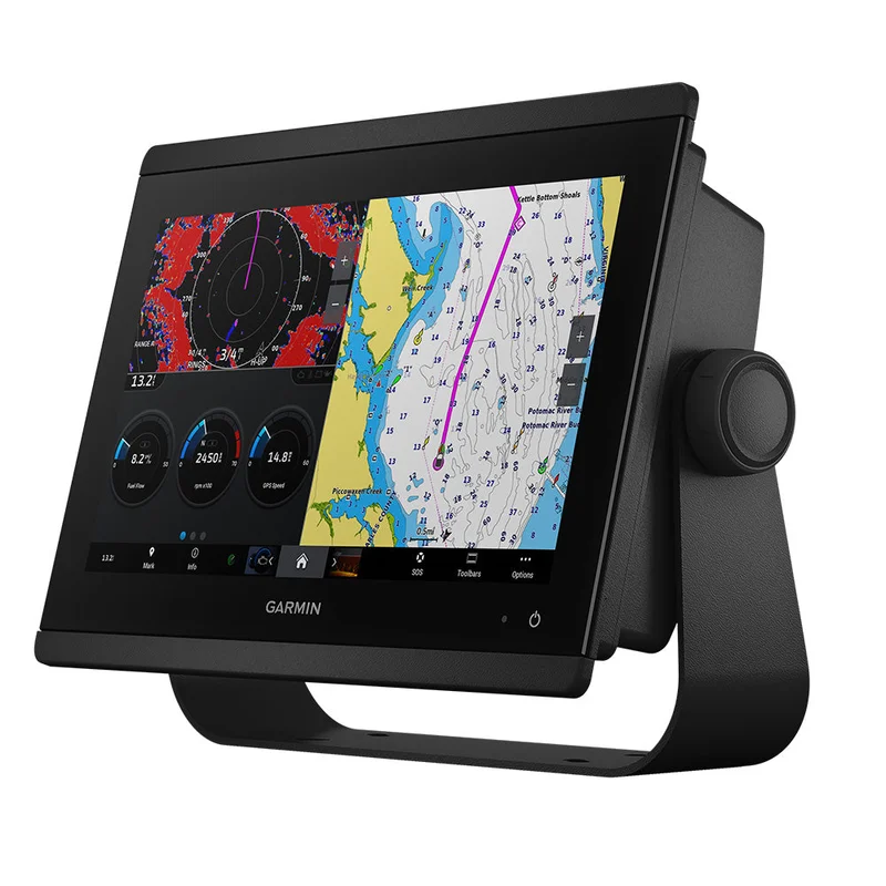
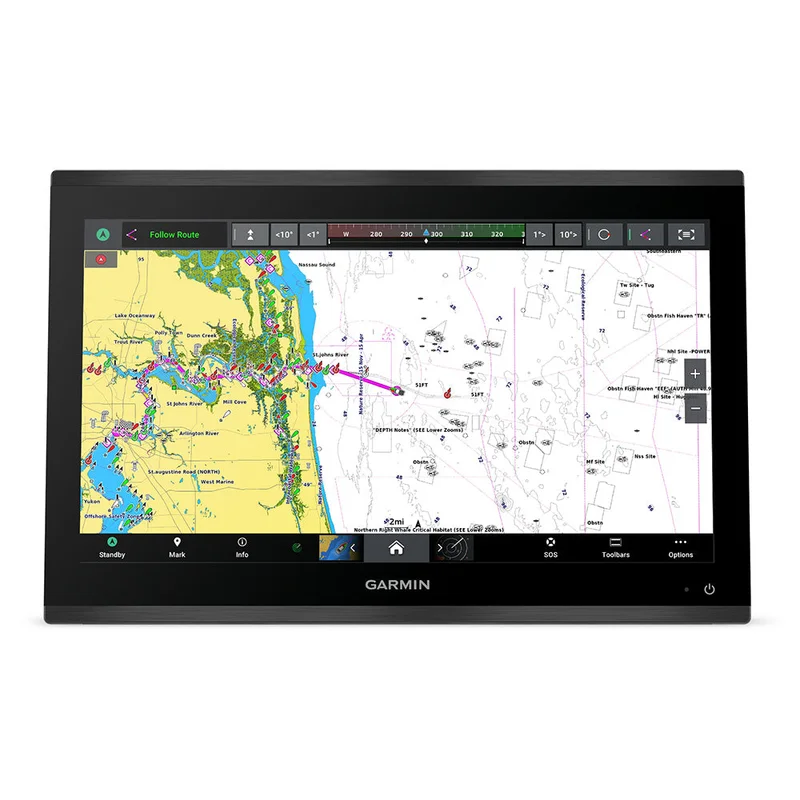
Get a sharper view from your connected helm with the GPSMAP® 1243 chartplotter. It’s high-resolution 12” in-plane switching touchscreen and ultra-sleek design seamlessly integrate into your Garmin marine system, putting full control at your fingertips. Preloaded Garmin Navionics+™ coastal charts and inland mapping feature Auto Guidance+™ technology (Auto Guidance+ is for planning purposes only and does not replace safe navigation operations) for helping you get where you need to go. Plus, there’s support for optional Garmin Navionics Vision+™ premium map content. Easily build your marine system — from compatible sonar and autopilots to compatible radar, cameras and multimedia — by using HTML 5.0, NMEA 2000® and NMEA 0183 networking, J1939 for engines, and the Garmin Marine Network. Add FrontVü™ forward-looking sonar (sold separately). (The ability to effectively avoid forward collisions with FrontVü sonar decreases as speed rises above 8 knots[HT1] ) which can help in avoiding underwater obstructions ahead. Or pair your plotter with your other compatible Garmin devices, such as quatix® smartwatches, wind transducers, wireless remote controls, and more.
⚠️ Confirm transducer compatibility before ordering. Transducers and accessories are sold separately unless this exact product title/package states otherwise.
Quick Details
- Model: GPSMAP 1243
- MPN: 010-02367-60
- Screen Size: 12″
- Touchscreen: Yes
- Transducer Included: Confirm before ordering
- Product Type: GPS – Chartplotters
- SKU: FT-97019
- UPC: 753759285241
- Chartplotter
- microSD preinstalled
- Power cable
- NMEA 2000 T-connector
- NMEA 2000 drop cable
- Bail mount with knobs
- Flush mount kit with gasket
- Protective cover
- Trim piece snap covers
- Documentation
- Garmin helm upgrades and replacement installs
- Boaters matching this exact part number or product package
- Marine electronics systems using compatible Garmin networking and accessories
- Customers who want a clean, properly matched display, sonar, charting, or accessory setup
What’s In The Box?
- Chartplotter
- microSD preinstalled
- Power cable
- NMEA 2000 T-connector
- NMEA 2000 drop cable
- Bail mount with knobs
- Flush mount kit with gasket
- Protective cover
GPSMAP® 1243 Chartplotter GN+
You’re a boater who wants premium features, maps, and charts for your connected helm. This crisp 12″ high-resolution chartplotter makes that wish come true.
Get a sharper view from your connected helm with the GPSMAP® 1243 chartplotter. It’s high-resolution 12” in-plane switching touchscreen and ultra-sleek design seamlessly integrate into your Garmin marine system, putting full control at your fingertips. Preloaded Garmin Navionics+™ coastal charts and inland mapping feature Auto Guidance+™ technology (Auto Guidance+ is for planning purposes only and does not replace safe navigation operations) for helping you get where you need to go. Plus, there’s support for optional Garmin Navionics Vision+™ premium map content. Easily build your marine system — from compatible sonar and autopilots to compatible radar, cameras and multimedia — by using HTML 5.0, NMEA 2000® and NMEA 0183 networking, J1939 for engines, and the Garmin Marine Network. Add FrontVü™ forward-looking sonar (sold separately). (The ability to effectively avoid forward collisions with FrontVü sonar decreases as speed rises above 8 knots[HT1] ) which can help in avoiding underwater obstructions ahead. Or pair your plotter with your other compatible Garmin devices, such as quatix® smartwatches, wind transducers, wireless remote controls, and more.
- Match the exact model number and MPN before ordering.
- Confirm transducer plug, network type, dash cutout, and mounting style when replacing an older unit.
- Some charting, satellite, app, mapping, or connected features may require compatible equipment or subscriptions.
- Auto Guidance and charting features are for planning only and do not replace safe navigation practices.
Specifications
- Cartography Brand: Garmin Navionics+
- Internal/External Antenna: Internal
- Screen Size: 12″
- Touchscreen: Yes
- Box Dimensions: 9″H x 12″W x 17″L WT: 12.7 lbs
- UPC: 753759285241
WARNING: This product can expose you to chemicals known to the State of California to cause cancer. For more information, visit P65Warnings.ca.gov.
Ordering tip: Confirm the exact Garmin model, part number, transducer needs, networking requirements, and mounting style before ordering.
Reviews
There are no reviews yet.